At first…
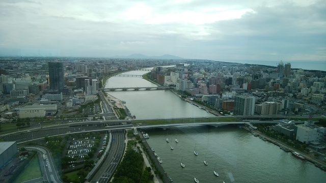
When you have arrived at Niigata-city, please go to the top of high building(ex. TOKI-MESSE or MEDIA-SHIP).
You would see the landscape of Niigata city from there 360°;
The Japan’s longest river 信濃川【SHINANO-GAWA】 is winding and running among town and flowing to 日本海【NIHON-KAI】Japan sea, with port called 西港【NISHI-KOU(South port)】, an entrance to 佐渡【SADO】island and 北海道【HOKKAIDOU】.
When you see an east area, there is the Japan’s widest river 阿賀野川【AGANO-GAWA】river and you would find 東港【HIGASHI-KOU(East Port)】international cargo port, factory industrial area, and international and domestic airport.
High way are connected to bypass roads which are running all through Niigata-city and you can use them for free (The most important transportation for Niigata people is cars), and there is also viaduct rail of 新幹線【SHINKANSEN(Bullet train)】to 東京【TOKYO】by 2 hours.
On the south area of Niigata station, you’ll find 鳥屋野潟【TOYANO-GATA】lagoon surrounded by 桜【SAKURA】trees and large park and huge rice fields bring rich harvest of Japan’s No.1 rice brand KOSHIHIKARI over that. There are also succor and baseball stadiums of Arbilex, and some amusement dorms.
As a name of 新潟【NIIGATA】means “New Lagoon” shows, there are lagoons water birds and nature watching can be enjoyed in west 佐潟【SAGATA】which is Ramsar convention registered, and north 福島潟【FUKUSHIMA-GATA】.
They all are on the huge plain called 越後平野【ECHIGO-HEIYA】facing to Japan sea, except 弥彦【YAHIKO】and 角田【KAKUDA】mountains looks far southwest area.

Leave a Reply